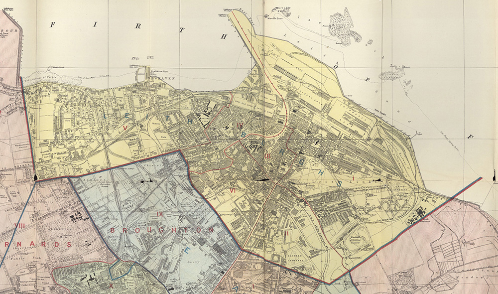
Leith Boundary Map

About this map
This is an extract from the ‘Post Office plan of Edinburgh, Leith, and Portobello, with suburbs’, published by W. & A.K. Johnston Limited in 1907. It is reproduced here by courtesy of the National Library of Scotland, under the Creative Commons Attribution licence. For further information and many more maps, please visit the NLS Maps website.
Leith is shown on the map in yellow, with the six municipal wards outlined with thin red lines and numbered with red Roman numerals. The name ‘Leith Burghs’ was the name of the parliamentary constituency (which also included Musselburgh and Portobello). The municipal boundary was the same as the parliamentary boundary. Areas shaded in other colours were not part of Leith. These boundaries applied until 1920, when Leith amalgamated with Edinburgh.
As can be seen, the Burgh of Leith included Newhaven and an area stretching westwards almost to Granton Harbour, but did not include areas south of Pilrig Street or (approximately) Albion Road. In recent years, there has sometimes been confusion about this.
Find out more
For further information, you may wish to visit the National Library of Scotland maps pages using the link below.